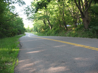
You knowhow I said I went for a long bike ride last week? Well, today I brought my camera and took pictures of my route!
Since I've been on this route before, I didn't need a map or anything. Usually, when I go out for a bike ride I check mapquest to find out the names of the roads I'm looking for and to get a general idea of the direction I'm heading in. It's more 'adventurous' to go without a picture of the route, but I think the next time I go 'exploring', I'll print a picture of the roads. That way, if I miss the road I'm looking for, I can look for a different route or turn back if I know it's close. This is what I would recommend to you too, after all, it doesn't hurt to be prepared!
First uphill^ Second^
^ A view of what I climbed
^ What I was going to climb at that spot ( I know it doesn't look that hilly, but these roads are very curvy so you don't know what you're going to get until you keep following the road)
^a view from the top
^First downhill whee!
Ant then this^ Where am I? Mount Everest? I kid, I kid. It's not very steep,
but it is a long, slow climb.
^A view of the hills and fields
^futher into the climb ^ the flat part/downhill
^major downhill, yay!
This pic really doesn't do the landscape justice, but you get the idea
I pretty much cruised downhill for a good 5-10 minutes, and then hit flat pavement for ~2 miles back to my apartment. Stay tuned for my dinner in the next post!


0 comments:
Post a Comment